Quite remarkable things happen when itinerant people set foot on small islands. Small is beautiful but small is also vulnerable so resilience and adaptability have to be the order of the day,
1 Skomer: a timeline
Skomer is a small cliff girt, treeless, island situated about a mile off the coast of South West Wales. In terms of its function as a human natural resource its history goes back to the migrations of the first prehistoric farmers. From this time to the present there has been a varying human presence in a long story in many episodes lasting thousands of years or just a few hours. Evidence for long term social dynamics rests with the development of field boundaries, where denuded plough lynchets and remains of stone walled fields show clear phasing among overlapping farming systems, all indicative of a complex cultural past.
Fig 1 Shearwater and Skomer
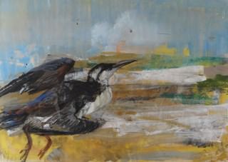
Ray Howard Jones, 1954
Present day visitors are taken on a tour of the roofless round houses and their associated field systems which have been dated to the Iron Age. The evidence comes from excavations at a prehistoric mound of burnt and fire-cracked stones once used to boil water for cooking. This has produced calibrated radiocarbon dates of between 751-408 BC, A cattle tooth deposited in the cooking mound was dated to around 85 BC.
Speculations about an even earlier culture have focused on a barrow associated with a considerable number of cairns. There is also evidence for possible megalithic structures. This would date the first human settlement to the of Neolithic or early Bronze Age. It is claimed that among these remains are at least three standing stone pairs which raises the possibility that they represent a small ritual site. This idea chimes with the latest ideas of the migration of Neolithic henge builders who spread from Orkney to Salisbury Plain, taking a route south along the western coastline of Britain. The bluestones, which mark an early conceptual stage of Stonehenge, were quarried a relatively short distance from Skomer and this positions the island within the epicentre of a ‘standing stone’ culture which transferred key cultural elements from Pembrokeshire to Salisbury Plain.
The first documents on Skomer appear in the mid 14th century when the island was established as a large rabbit warren. A set of accounts recording this operation was compiled by the Norman administration of Haverford West, where the island was an extension of the castle’s community of St Martins.
It seems that the island was uninhabited during the medieval period except for the seasonal visits of warreners and cattle farmers.
The ruined farmhouse, and surrounding large rectangular fields that now dominate the centre of the island were erected in the 1840s by the mainland owner as an investment for the rental market. The returns from agriculture were probably marginal and over the years the island came to be valued more for its exceptional wildlife. This phase culminated in Skomer being declared a national nature reserve in 1959. It is now staffed by a manager and volunteers of the Wildlife Trust of South and West Wales. Old farm buildings have been converted as visitor accommodation and there is a daily boat service most of the year. There is a house for the manager to which is attached a small laboratory with accommodation for field workers. However, my first visit to Skomer predated these comforts. The boat was unpredictable, boarding was either direct from the beach or a convenient rock face and the accommodation was primitive.
2 Coming to Islands
My first view of Skomer was in the autumn of 1969, a decade after it had been declared a national nature reserve. Looking to the west from the mainland across a misty, rainy, Jack Sound from the shelter of the coastguard hut at the top of the Deer Park, I was fascinated by a group of several hundred diving gannets, a reinforcement of the feeling of being immersed in a powerful local wildness. Looking to the south west I could see the island of Skokholm, a small smudge on the grey horizon. Skomer’s nearness is deceptive, although only just over a mile as the crow flies from Martin’s Haven, it could take two men rowing up to three quarters of an hour to reach Welsh Way, which was the southern point of access until North Haven was made accessible by the Victorians and their dynamite. This day, on a rare borderline between humankind and nature, began a mindful intellectual link with Skomer, which has lasted to the present day.
Islands occupy a significant space in the human mind because they are good places with with which to think. They are more than scenic locations. Their natural boundaries help shape and contain narratives. In my case they are places where poetry and contemplation happen, and I was in search of somewhere to link these powerful social expressions of human wellbeing by making connections between ecology and culture. Up to that time my scientific career had been based on reductive concepts that came from the biochemical laboratory. I was in search of the bigger outdoor picture of evolution. This shift in outlook began during the mid 1960s in Sheffield, where I was Reader in Endocrinology and Metabolism. The change in mindset emerged during the co-supervision of a PhD project into how freshwater shrimps could survive in the tidal estuary of the River Esk at Whitby. My new scientific outlook came into a much sharper focus when I was offered a place on an international team studying the physiological survival strategies of animals living at the boundary between the River Amazon and its largest tributary the River Negro. Our base was the spot where, a century before, a pair of British naturalists and explorers, Henry Bates and Alfred Russel Wallace, had located their expedition. When Bates arrived home in 1859 after a full eleven years, he had sent back 14,712 species, mostly insects, of which 8,000 were new to science. From these findings Bates gave the first scientific account of mimicry in animals. The scientific continuity embedded in this small spot on planet Earth was sometimes overwhelming.
Bates and Wallace had begun to explore the Rio Negro or “Black River,” and noticed that the water seemed darkly stained, like tea or coffee. Similar, smaller rivers can be found across the northern Amazon basin. Such rivers are usually deep, slow-moving, and wind through peaty forests or swamps. Where the blackwater of the Rio Negro meets the silt-laden, “whitewater” of the western Amazon Basin, the transition is sharp and visible from space. Our research soon revealed this was an amazing juxtaposition of two entirely different outcomes of evolution expressed in food chains and survival mechanisms This distinct river ecologies also determined diverse cultures of the rivers’ native settlements, which set seeds of cultural ecology in my mind.
The new mindset that was emerging from contact with the diverse tropical rainforest was a response to the fact that educationalists generally do not face “nature” as a whole as an objective and invariant reality, but only in its parts. The reality I had been taught to perceive always implied an isolated subjective and variable component. In truth, the operational reality of the living world can only be systematically and gradually perceived by enlarging its systems and differentiating their elements and relationships. Systems thinking with mind maps is therefore a necessary tool for human progress on an overcrowded planet. It implies both analytical and synthetical processes and thus is sometimes called a “holistic approach” to nature. Education is not something to keep in closed conceptual boxes, even when the box is classroom-shaped. The habit of learning, an urge to find out more, is developed when we feel inspired. The world outside the lecture room is richly inspiring, constantly re-energising what takes place within. It is the source of all our learning: about our history, about our culture, about our place in the natural world and our relationships with each other. This two-way flow can be embedded in every child’s education, entirely at ease within any age group and any teacher’s ethos. Sadly an out of date European education system devised to establish and exploit empires gets in the way.
Sheltering from the weather on the edge of the world, watching the primeval interaction of predator and prey, I needed poetical inspiration to express the wild reality in front of me, which could describe and transmits ecstasy while retaining a practical awareness of the world as a system that goes on relentlessly driven by interlocking food chains. It was not until 1992, the year of the world summit to launch a strategy to save the planet, that the American poet Mary Oliver captured my mood of 23 years ago, when I vowed to bring students to this place where they could determine for themselves their place in nature.
I am watching the white gannets
blaze down into the water
with the power of blunt spears
and a stunning accuracy–
even though the sea is riled and boiling
and gray with fog
and the fish
are nowhere to be seen,
they fall, they explode into the water
like white gloves,
then they vanish,
then they climb out again,
from the cliff of the wave,
like white flowers–
and still I think
that nothing in this world moves
but as a positive power–
even the fish, finning down into the current
or collapsing
in the red purse of the beak,
are only interrupted from their own pursuit
of whatever it is
that fills their bellies–
and I say:
life is real,
and pain is real,
but death is an imposter,
and if I could be what once I was,
like the wolf or the bear
standing on the cold shore,
I would still see it–
how the fish simply escape, this time,
or how they slide down into a black fire
for a moment,
then rise from the water inseparable
from the gannets’ wings.
The depiction of Skomer in its wildness was the aim of the Welsh painter, Rosemary Howard Jones. Rosemary, known as “Ray”, grew up near Cardiff and on a visit to Pembrokeshire as a child fell in love with the coastline that was to hold and sustain her throughout her life. In the 1950s she spend long periods on Skomer living in the ‘Rabbit Catcher’s Hut’, with her long-term partner, photographer Ray Moore. The hut had basic furniture the pair had made from driftwood. I remember discussions with her about the merits of the interwar poets in her silver caravan permanently parked just within the gate to the Deer Park when she was regarded a rather eccentric recluse, Another image is of her sitting gross legged in the prow of the boat going to Skokholm, drenched with spray, anorak turned up, sketching the waves breaking around her (Figs 1 & 2)
Fig 2 Sunset on Skomer
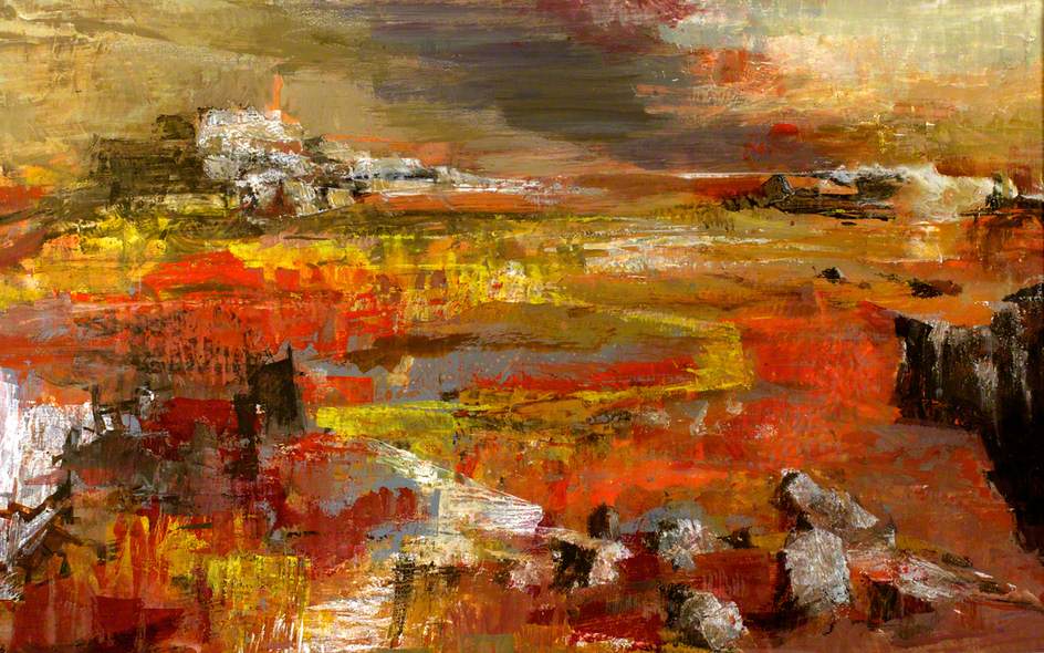
Ray Howard Jones (circa 1950s)
3 Skokholm: a scientific outpost
It was in fact the island of Skokholm, not Skomer, that had first attracted me to Pembrokeshire, with the objective of organising a research project on its colony of house mice. Mice live freely all over Skokholm in a population that had then been in existence for more than 70 years. The ecological genetics of these animals had been studied intensively from 1960 to 1969 by the geneticist Sam Berry, who had set up a small field laboratory on the island for this purpose. At that time I was co-director of the Nuffield Gerontology Laboratory at Hull University and had just been appointed head of the department of zoology in the University of Wales at Cardiff. The aim of my research on Skokholm was to investigate to what extent studies on laboratory animals could be extended to animals in the wild. Put simply the question is, do mice in the wild age in the same way as mice bred in the laboratory?
The other important historical feature of Skokholm that had brought me to this part of South Wales, was the significant position of the island in the the development of the science of ecology. The key local figure was Ronald Lockley, a farmer and naturalist, who took a lease on the island and began from 1928 to study migratory birds using the ‘new’ technique of ‘ringing’. He established the first British bird observatory on Skokholm in 1933, One of its early pieces of research was Lockley’s work in 1936-7 with David Lack on the homing behaviour of the Manx Shearwater. Their ringing experiments showed that this bird, which nests in large numbers on Skokholm, can successfully return to the island from great distances. This involved taking birds to Venice!. The farthest distance of Skokholm from Venice, is about 930 miles direct, while if this bird travelled the whole way back by sea it must have covered at least 3,700 miles.
The other important biological principle that arose out of discussions among the many ornithologists who visited the bird observatory in its early days, led to David Lack’s ruminations on the fact that islands demonstrate that, the smaller and more remote the island, the more impoverished the bird fauna compared with the mainland. This is possibly the most general pattern found in ecology, and many explanations have been proposed. The relationship between island area and number of species is now well known: larger islands contain more species than smaller islands. Furthermore, “Islands” can be used to refer not only to pieces of land surrounded by water, but to habitat islands as well, such as lakes, forest fragments, etc.
Regarding my work on the ageing of Skokholm’s wild mice, which was carried out in the early 1970s, individuals were allotted to eight age-classes on the basis of tooth wear, such that the oldest group were over a year old and had survived the previous winter, while the others had all been born in the current breeding season. This gave a maximum life span of a year. In the laboratory, these mice lived, as do laboratory mice, for a maximum of around three years.
Molecular markers showed that natural selection was operating on the wild Skokholm mice, so that the age groups were not genetically homogeneous. Animals living a few metres apart were different genotypes. A number of characters were shown to be age-correlated, and their importance varied in mice from different habitats; no one trait could adequately describe the observed changes with age. The conclusion is that ageing studies carried out on ‘standardized’ laboratory animals in a necessarily over-simplified experimental environment may give results misleading to gerontologists. Human ageing does not occur in the wild because individuals die of disease or predation before they can experience it.
Rabbits are the other small mammal living wild on Skokholm, and Lockley, in his capacity of farmer, engaged with them as a pest that was frustrating his efforts to make the island pay as a commercial enterprise. In this connection he adopted every new pest control system that was developed to exterminate them. So it was that Sir Charles Martin brought the virulent strain of the virus known as Myxomatosis cuniculi to the island. In his choice of Skokholm Sir Charles had decided that the possibility of the virus being carried from Skokholm to wild rabbits elsewhere was too remote to constitute a public danger. He made three separate attempts to induce myxomatosis in Skokholm rabbits in 1936, 1937 and 1938. Although in each attempt the rabbits inoculated with the virus appeared to have died within the usual period of less than fourteen days, there was little or no spread to uninoculated rabbits. The result of the Skokholm experiment was to dismiss any use of the virus as a rabbit control measure.
However, in October 1953 myxomatosis’ was introduced into south-eastern England by unknown means and was first notified in October 1953. Attempts were at first made to eradicate it, but it spread and was established at twelve places in the south-eastern counties by the spring of 1954. It was recorded from Wales in May and from Scotland in July, its spread in these cases having undoubtedly been helped by the transfer of diseased rabbits to uninfected areas. Most of England and Wales south of a line from the Wash to the Wirral peninsula was affected by the end of 1954, and every county in northern England had some infection. Deliberate spreading of the disease by transfer of infected rabbits was made an offence in November. Virulence remained high, generally with a mortality of about. 99 per cent., through 1955, and the disease was present in most parishes in Great Britain by the end of the year. After an epidemic, which killed up to 99% of mainland animals, sporadic cases continued to occur among the depleted population to the present day.
4 Skomer: rabbits and vegetation
A broad scientific framework for understanding the natural history of Skomer was established in a report of a seven month long expedition to survey the island, organised by the West Wales Field Society in 1946. At that time Skomer was emerging from a period during the war when rabbits had been culled in a semi-agricultural system and the central fields had been lightly grazed by a few cattle and sheep . Short rabbit nibbled floriferous pastures dominated the landscape, which were described as being springy and pleasant to walk over.
The principal vector of myxomatosis in Britain in 1954 and 1955 was the rabbit flea, Spilopsyllus cuniculi. Rabbits remained numerous on the island of Skokholm where they were free from fleas, but nearly all were destroyed on Skomer. When I first set foot on Skomer in 1971, the rabbit population was subject to a year on year cyclic rise and fall as myxomatosis had begun to equilibrate with its rabbits and their fleas. From an island that in 1957 had been lush with grass it was returning to a more patchy landscape dominated by common rabbit resistant plants . In the late 1960s the springy turf had been reduced to a very thin covering, with many mossy patches and bare ground. The turf was no longer thick enough to feel pleasant underfoot. Because rabbits live at a such a high density, up to 40 per acre on Skomer, every part of the island, apart from the cliff ledges inaccessible to them, was affected by their burrowing, trampling, scraping, defecation and grazing. There were fears of soil erosion, particularly on the western cliff tops, where nesting burrows of shearwaters and puffins were at risk.. Also, there were several large expanding gull colonies in the centre of the island feeding on household food waste available on mainland rubbish dumps.
As a result of discussions with the staff of the Nature Conservancy Council who were managing the island, it was agreed that I should evaluate the idea of an imminent erosion threat. This would involve undergraduates from my department spending two weeks on Skomer in long term group work on the impact of rabbits and gulls, but they would also have their individual self motivated projects that would throw light on the ecological dynamics of other species and give them a taste of what real scientific thinking was about. For the first few years of this work the Cardiff student group was based in the ‘Rabbit Catcher’s Hut’ at the farm..
Long term effort was required because everyone recognised that ecological processes occur and interact at various spatial and temporal scales that require long periods of surveillance to detect and evaluate. In contrast, most ecological research occurs over short periods of time and is limited in its spatial extent, restricting our understanding of longer-term and broader-scale processes. The resulting gaps in our ecological knowledge are sometimes labelled the “invisible present” and the “invisible place”. Without baseline data to provide a reference it is difficult to infer what long-term changes may be occurring and whether short-term local studies are representative or merely anecdotal. Although top-down effects of particular herbivores and carnivores at the landscape level are now well-recognized, these have generally been demonstrated to occur locally and over short periods of time. Importantly, we now have ample evidence that herbivores such as rabbits and deer can dramatically affect plant communities derived from fenced exclosure studies, island studies, and direct observation. Nevertheless, doubts and uncertainty persist concerning whether such long term impacts are serious or pervasive and how long they persist.
It turned out that Skomer’s gull problem was a temporary one and by 1985 the number of breeding pairs had dropped to about 10% of the 1960s peak. Regarding rabbits, looking back three decades we can now see that the catastrophic effect of myxomatosis on Skomer had set in motion long term ecological forces expressed in repeated cycles of plant succession. This produces a fairly predictable surface mosaic related to the rise and fall in the rabbit population, punctuated by rare winter inundations of the island by gale-born salt spray. Regarding weather, the log of the 1946 expedition to Skomer recorded a severe September gale that snapped bracken stems about a foot from the ground, withering vegetation well into the centre of the island.
Looking back, these relatively short lived grassland microcosms characteristically appear and disappear in cycles of plant succession, occupying decades and take place alongside population trends in longer lived colonies of bracken and heath. At any time the botanical patchiness of Skomer is revealed as a dynamic mosaic of microcosms, with long and short periods. The longer trends, particularly in heathland, are possibly the outcome of local climate change.
The above conclusions have come from a few sampling sites representative of unenclosed cliff tops and the large central fields. However, the island has been compartmented by generations of prehistoric farmers eking out a living from a relatively small space. Aerial surveys have shown that this has resulted in a complex pattern of small enclosures now only visible at ground level, which extend below the much larger Victorian enclosures. This raises the question as to what extent this prehistoric field pattern is influencing the current pattern of vegetation. Phosphorus is unique among the elements in being a sensitive and persistent indicator of human activity. It has long been of interest to archaeologists because of its potential to inform them about the presence of past human occupation and to offer clues regarding the type and intensity of human activity. In particular several properties of phosphates lead to long-lasting residual ecological effects of phosphate used for crop fertilization. Phosphorus occurs in the soil in several different chemical forms, most of which are relatively insoluble in water, sensitive to pH changes, and immobile. Soil phosphate can also be grouped into inorganic and organic forms. On Skomer the use of phosphate fertilizer, from manure, is evident in the distribution of stinging nettles Availability of phosphate is the chief factor affecting their distribution and they may be taken as indicators of the effects of prehistoric agriculture. For example, in a small prehistoric rectangular enclosure the vegetation inside can be quite different from that outside. In particular, nettles are found inside but not outside.
5 Skomer: aerial drone surveys
Vegetation is more of a continuum than a set of distinct units. Holistic knowledge on vegetation heterogeneity, scenic patterns and species dynamics is therefore an indispensable prerequisite for identifying and understanding ecological processes and hence, providing subsequent insight for managing ecosystems . Geographic Information Systems (GIS) represent a considerable change in environmental data management, as they connect territorial information to different databases, allowing for the “integration” of the territory, adding and producing new information. The use of remote sensing tools, permits the gathering of many kinds of territorial information and the investigation of aspects that are difficult to monitor.
The ability to estimate plant distributions over large areas (i.e., several hectares) using traditional approaches (transect or quadrat methods) is generally limited because of the time and expense required. Intensive plant surveys may also result in unacceptable levels of disturbance to sensitive ecosystems due to soil compaction, disruption of soil organic layers, trampling, and vegetation damage. This is an important issue on Skomer where there is a high density of relatively shallow nesting burrows. Remote sensing via satellites provides information on landforms and the general distribution of vegetation types over large areas. However, it is unlikely to provide adequate spatial or temporal resolution for determining the distributions of individual species or fine-scale differentiation among surface landscape features and vegetation types. Moreover, available satellite images may not represent optimal phenological stages for the identification of different species and vegetation types. Manned aircraft and large drone surveys can have increased resolution, but are prohibitively expensive for most investigations. Generally, they do not provide a high enough resolution to assess the distributions and compositions of plant communities. On the other hand, utilization of micro–unmanned aerial vehicles (UAVs, unmanned aerial systems [UAS], small aerial drones) do provide adequate levels of image detail to estimate the distribution of individual plant species or vegetation types over several hectares at a relatively low cost. Therefore, in 2017, to get the holistic picture of Skomer’s vegetation, drone technology will be applied to make a digital surface model. The goal is to define the advantages and limitations of small aerial drone surveys covering the whole of the island for estimating the distributions of individual plant species and vegetation types making up the surface landscape at fine spatial scales. In particular, the aim is to plot the impact of rabbit behaviour. Hopefully this will be a fifty year old dream come true.
6 Web appendices
A campfire meditation
7 Web references
http://heritageofwalesnews.blogspot.co.uk/2011/12/recent-work-on-skomer-island.html
http://www.coflein.gov.uk/en/site/24369/details/settlements-and-field-systems-skomer-island
http://heritageofwalesnews.blogspot.co.uk/2014/10/first-scientific-dates-tell-story-of.html
http://www.scotsman.com/heritage/people-places/nine-abandoned-islands-of-scotland-1-4095071
https://www.ncbi.nlm.nih.gov/pmc/articles/PMC4843653/
http://www.orkneyjar.com/archaeology/nessofbrodgar/
http://www.sciencedirect.com/science/article/pii/S0168952512001953
https://en.wikipedia.org/wiki/Cissbury_Ring
http://www.pnas.org/content/104/39/15276.ful
http://www.theatlantic.com/photo/2012/03/a-world-without-people/100264/
http://www.viralnova.com/reclaimed-by-nature/
http://www.cabinetmagazine.org/issues/20/dillon.php
http://apexart.org/exhibitions/amby-nipper.php
http://dream-islands.wikispaces.com/Scope+of+islands
http://sro.sussex.ac.uk/42961/1/English,_Judie.pdf
http://www.alastairmcintosh.com/articles/2013-Island-Spirituality-by-Alastair-McIntosh.pdf